7 Tips to Hike Mount Elbert, Colorado’s Highest Mountain
Disclosure: This blog has affiliate links, and it’s how I can keep doing what I love. If you book something, I might make a commission with no added cost to you. Thanks for the support!
Do you want to hike Mount Elbert, Colorado’s tallest mountain, this summer? Even if you’re not much of a hiker, you should GO FOR IT!
When I was thinking about it, I was frustrated with the guides online, which aren’t very clear and make the hike sound complicated. That made me debate whether or not I could do it.
But having done it and finished it, I realized the hike up Mount Elbert is VERY simple.
Believe me when I tell you, the trail up Mount Elbert is just another hike… just, a really long and steep hike.

Summiting Mount Elbert is easy and doesn’t require any mountaineering techniques.
You may have seen it’s a class 1 hike. All that means is that the hike is on a well-maintained trail (so, no scrambling or climbing), there’s pretty much no risk involved, and it requires no technical gear.
So, yeah, it’s just another hike… up the tallest mountain in Colorado and 2nd-tallest in the continental USA!
I love looking at hike statistics, and these were mine on the Northeast Ridge trail:
- Distance: 10.73 miles (27,128 steps!)
- Elevation Gain: 4,533 feet
- Moving time: 5 hours, 20 minutes (but it actually took about 8 hours)
- Calories: 1,571 calories burned

So, all it takes to hike Mt. Elbert is leg endurance. So, stop wondering…
You can and SHOULD hike Mount Elbert!
My trip there was an unexpected delight and turned out to be the best decision.
My Mount Elbert Hike Story
I’m a planner, but hiking Mount Elbert was a total spur-of-the-moment decision that paid off in pure enjoyment.
I was driving the highway with my wife Lala and our friend Verena during our epic Colorado road trip.
We had just done an incredible hike in Aspen and spent 4th of July there, and were driving towards Denver. But, as we rounded a corner, we hit a pretty straight section of road on the way to Leadville.
And what a view welcomed us!
As you drive that road, you have two incredible mountain peaks on your left for about 12 minutes. I was stealing glances at the mountains as I drove, and I just happened to ask, “What mountains are those?”
Verena looked it up and she said they were Mount Elbert and Mount Massive – and, oh yeah, they’re the tallest and 2nd-tallest mountains in Colorado!
We drove on in silence and then I asked, “Should we hike it?”
What was really a question to probe their willingness to do something crazy like that quickly turned into researching the hike, seeing if we could change our plans and figuring out where to sleep.
And just like that, that 12-minute view changed our plans and added an awesome feat to our road trip!
How to Hike Mount Elbert
Like I said before, hiking Mount Elbert is really quite simple. So, I’m going to lay it out real quick and simple.
But if you want a more detailed guide, I used the guide on 14ers.com, which is really good, has a ton of pictures and almost too much information.
- First, park right at the Mt. Elbert Trailhead (not Mt. Elbert East Ridge Trailhead or Black Cloud Trailhead, which are for other routes to the same summit). This parking lot is right next to the Northeast Ridge trail.
- The trail has really clear signs all the way, and only the very beginning has any forks in the path. At the first fork in the road, go left onto the Colorado Trail. Then, you’ll hike up a steep slope and go right when you get to the top. Finally you’ll get to a junction and turn right to follow the North Mt. Elbert Trail. After that, the trail is straight up to the summit.
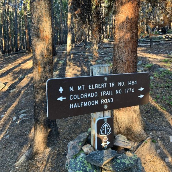
- The next milestone is the tree line! Just know there’s a false tree line on the way. You get to a clearing and might think you’re there, but there’s still half a mile left to the actual tree line. Once there, have a snack and rest up for what’s coming!
- From here on out, just follow the well-defined trail. It starts out as a combination of dirt and rocks and then becomes rockier the higher you get.
- FYI, the hike up Mt. Elbert has 3 false summits! You’ll see a “summit” way in the distance and, when you get there, find out there’s way more to go – 3 times! Be ready for that mind game.
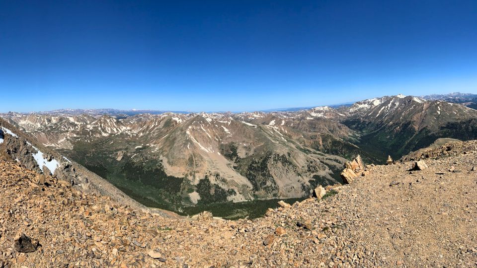
- The summit is absolutely gorgeous, with a 360-degree view of gigantic, white-tipped mountains all around. My favorite view was to the west, where the horizon was just mountains to the edge of the earth. You can also see Twin Lakes from up top.

Now, lets get into some helpful tips to hike Mt. Elbert as a first-timer.
7 Tips to Hike Mount Elbert
1. Where to Sleep Before the Hike
I’m all about making adventure travel affordable and have spent 2 years road tripping across the US in my SUV without spending much money!
A huge part of making it possible has been finding free camping, and Mount Elbert is one of those places where you don’t have to spend money to have fun.
The night before my Mt. Elbert hike, I slept in a dispersed site on FS Rd 152. The coordinates for this free campsite near Mount Elbert are: 39.193472, -106.381528 and it’s 12 minutes from the Mt. Elbert Trailhead.
But, apart from this site, there are lots of other options!

Each one of the teal bookmarks is a potential free campsite, and I marked them because I like having lots of options. I didn’t test them all, though, because Plan A above worked perfectly.
The map doesn’t provide specific locations, and it’s because I don’t want to lead you somewhere bad. I just wanted to show you that there ARE lots of options.
So, when you do your research on the apps Campendium or iOverlander before you go, you can plan accordingly and even see people’s reviews! That way, you’ll choose a place you’re comfortable with that has been proven to be free (and legal).

I created a map of all the free car camping sites I found during my Colorado road trip, and you can access it here for FREE:
There are also several paid campgrounds near Mount Elbert: Elbert Creek and Halfmoon East and West.
Just make sure, if you’re doing the easy Northeast Ridge route, not to sleep near Twin Lakes, since that’s about 40 minutes away!
Finally, if you’d rather stay at a hotel, find one in Leadville, which is just 26 minutes from the trailhead. Check out the map below to see all the possibilities!
2. Start between 5 and 6:30 a.m.
Since this isn’t just any hike – it’s a hike to Colorado’s tallest peak – you need to start early.
I got to the trailhead at 6:30 a.m. and it the parking lot was already jam-packed! I had to park pretty far away from the trailhead on the side of the road.
So, it may be better to start more like 5:30 or even 5 a.m. to beat the crowds and the storms. (No worries if you start later… even more people started after us but starting late makes it more likely you’ll have to turn back).

Why start so early?
- The crowds: This is obviously a popular trail, since it’s the easiest route up a very meaningful mountain. So, if you want the trail to yourself, you’ll want to start real early. Bonus tip: try to do this hike during the week so that there are less people around!
- The storms: Summer in the alpine is absolutely gorgeous, but afternoon storms are very common. If you see one approaching, you just have to turn back because you’re too exposed on the mountain. So, to increase your odds of summitting, start early so that no storm can stop you!
3. Eat Before Starting you Hike
If you give your body some much-needed energy before you hike Mount Elbert, you’re going to feel better throughout the day.
It doesn’t have to be much, especially since you’re starting early.
A granola bar would be ideal, or you can have some overnight oats (it’s what I did). You just put oats, water or milk, and peanut butter in any container, stir it up, and let it sit overnight. Then, eat it in the morning with some crunchy granola.
Whatever you eat, just get some good CARBS!
I’ll give you some food ideas for the hike later.
4. Why Climb the Northeast Ridge?
To hike Mount Elbert in the summer, you have 3 different route options: the Northeast, East or Southeast Ridges.
The Southeast Ridge is the most difficult of the 3, and it’s actually a class 2 hike. But that doesn’t mean it’s THAT hard. It just involves a little more scrambling and trail-finding. It’s 10.5 miles long with 5,300 feet of elevation gain.
The East Ridge is a class 1 hike and it’s longer (11.25 miles) but only has 4,200 feet of elevation gain. The main parking lot is difficult to get to without 4WD or AWD. So, the hike is longer if you have 2WD because you have to park in the secondary lot.

The Northeast Ridge is class 1 and it’s 9.75 miles long (although I got 10.5) with 4,300 feet of elevation gain. It’s the easiest route to follow and the best overall experience if you’re a novice hiker and don’t mind somewhat of a crowd.
5. What Gear/Supplies to Take
Like I said before, you don’t need any technical gear to hike Mt. Elbert, but taking the right supplies will help make your experience better.
- I took 2 liters of water (half a gallon) and that was enough for me. I did finish it all, so a little more might have been better. A Camelbak, one of those cool water backpacks would be ideal for this hike.
- When it comes to clothing, I would recommend light pants and a fleece shirt, plus a fleece jacket because the wind gets super cold and strong up high. I had to put it on every time I stopped, and then I would take it off while hiking.
- In terms of shoes, you don’t need hardcore boots. Just take shoes that you’ve broken into and had good grip and you’ll be good to go. They could even be tennis shoes.

- When it comes to food, pack light but high-calorie snacks. You could take gels to pack super light, but that’s stuff’s for athletes. I love sitting down to have a meal at the summit. So, I like taking granola bars and simple carbs on hikes (maybe take advantage of the exercise and eat some candy – you need the energy). For the summit, I’m a big fan of a big peanut butter and banana sandwich.
- My final gear tip for hiking is to take hiking sticks. This is especially useful if you don’t hike that much – hiking sticks really make a difference! And they’re spectacular for taking some of the load off your knees on the way down. I didn’t use them, but Lala has some hip issues and using hiking sticks help her go anywhere!
6. Know When to Turn Back
A big part of hiking a fourteener is knowing when to turn back.
The most common reason to turn back on a hike in alpine Colorado is storms. If you see a storm on the way, just turn back immediately.

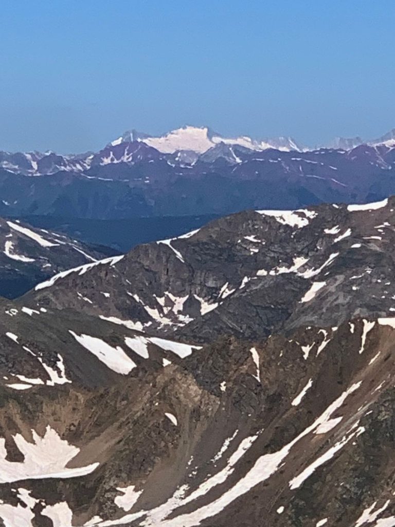
See, the mountains are bare way up in the alpine, which makes you the most prominent feature. That means the chances of getting struck by lightning are WAY higher. We don’t want that, so turn back if you see a storm.
Another reason you might have to turn back is if you get altitude sickness, but it’s not common.
That being said, there was a woman when we hiked Mt. Elbert who threw up and had a headache. People advised her to turn back immediately, and she did.
So, if you vomit, get a bad headache or feel unnaturally tired, turn back and get someone to with you.
To make sure you don’t get altitude sickness, just hike in the Colorado mountains for a few days beforehand and your body will be ready for Mount Elbert.

7. Use AllTrails to Hike Mount Elbert
If you want the added security of knowing where you’re going, download AllTrails!
The paid version of the app works really well and you can use it offline (although you get good signal on a lot of this hike).
But you can still use AllTrails offline without paying the subscription.
All you have to do is look for the hike you’re about to do (in this case, North Mount Elbert). Then, just start your hike on the app while you still have signal and it’ll work the entire way up.
Using AllTrails is also a great way to log all your hikes.
And just like that, you’re all set to hike Mount Elbert without any issues! Don’t worry about anything – keep it simple and have a blast!

Frequently Asked Questions
The easiest trail up Mount Elbert is the Northeast Ridge trail, which starts from the Mt. Elbert Trailhead. You hike a total of 9.75 miles and gain 4,300 feet of elevation.
The East Ridge is actually less elevation gain (4,200 feet), but it’s 11.25 miles long. I prefer the elevation over the extra mile and a half!
It took me 8 hours to hike Mount Albert, including all the time I stopped to rest. But my actual hiking time was 5 hours and 20 minutes. I ended up hiking from 6:30 a.m. to about 2:30 p.m. If you’re a strong hiker, you could easily be done by noon!
Yes, you can do Mount Elbert and Mount Massive in one day because they’re right next to each other, but it’s a BIG day and there’s no official trail between them! You should only try it if you’re an experienced hiker.
While you could hike up and down each peak, since both trailheads are right next to each other, that would be a bore. So, the typical route is to make a big loop, summitting other mountains as you go. It has some class 3 hiking and lots of difficult route finding.
Check out a map of the Mt. Elbert to Mt. Massive hike here… and good luck!
I burned a total of 1,571 calories as a 167-pound guy. It’ll be different for you based on your weight and gender, but the point is: you’ll burn a LOT of calories hiking Mt. Elbert.