How to Hike to Lake Dorothy, Colorado and Camp for Free
Disclosure: This blog has affiliate links, and it’s how I can keep doing what I love. If you book something, I might make a commission with no added cost to you. Thanks for the support!
The mountains around Denver are spectacular and wild! That’s especially true of the hike to Lake Dorothy, Colorado, which has to be one of the best day-hikes you can do from Denver.
I hiked to Lake Dorothy while doing my epic Colorado road trip, and that trip was full of gorgeous lakes and mountains.
But the hike to Lake Dorothy was my favorite of all of them.
In this article, I’ll cover how to hike to Lake Dorothy in Colorado (it’s pretty straightforward except for 2 parts where the trail splits). But I’ll also include where to sleep nearby for free so that you can get an early start!

The whole journey to the lake is just wild and gorgeous, especially in the summer.
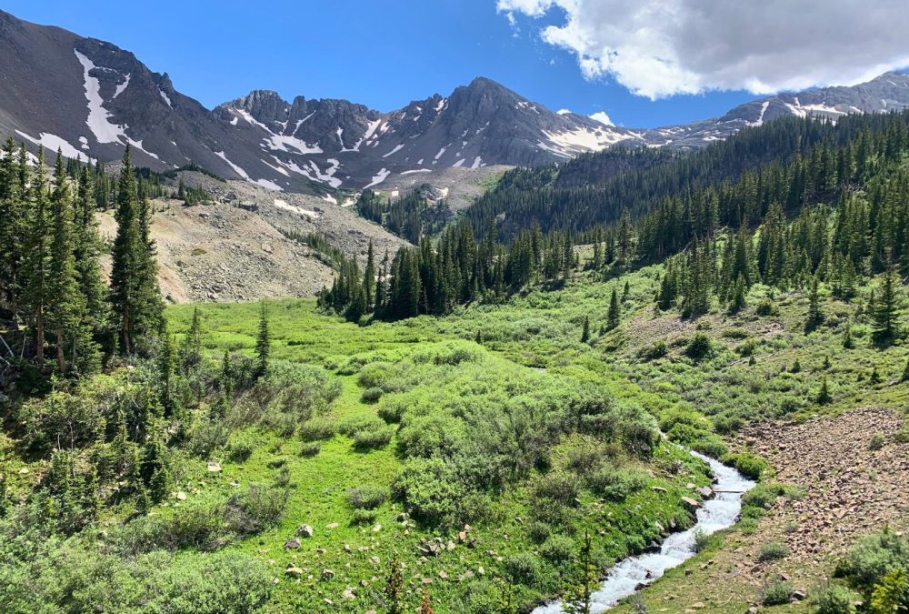
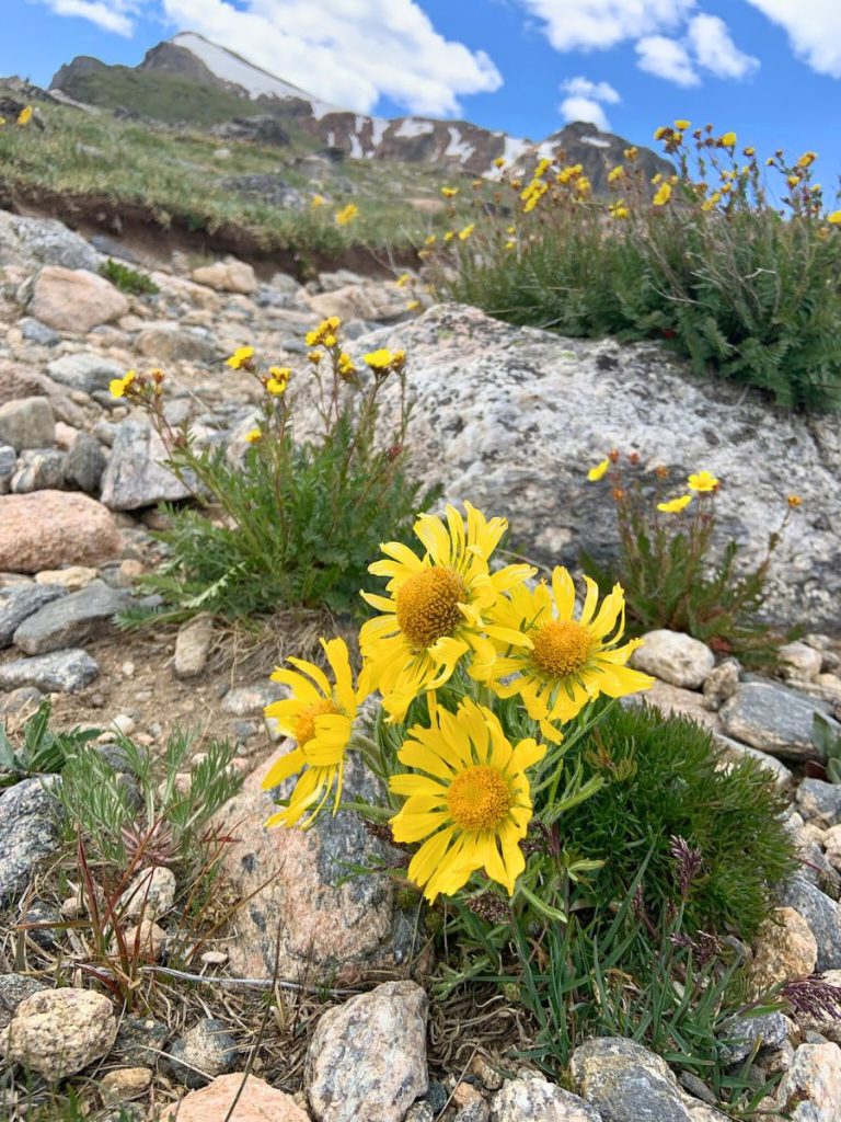
You hike through the greenest trees – pine trees and leafy trees alike – and the number of flowers you can see in the summer is astonishing. Plus, I lost count of how many times I had to cross water going over the trail. It was SO refreshing to be out there.
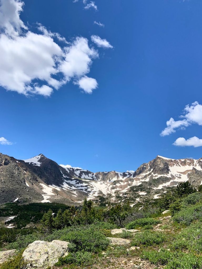
Beyond that, the mountains and a beautiful dark green up to the tree line, where the bare, craggy peaks are an artistic combination of grey rock and white snow.
All of that, against a baby blue backdrop of the summer sky is a memory I will always cherish.
I LOVE Colorado.


Lake Dorothy Hike Stats
I’m a nerd when it comes to stats and all that fun stuff! Here are the statistics from when I hiked to Lake Dorothy and back, including distance, elevation gained and calories burned:
- Distance: 7.7 miles (16,956 steps!)
- Elevation gain: 1,944 feet
- Moving time: 3 hours (including rests, it was about 4.5 hours)
- Calories: 1,127 calories burned
How to Hike to Lake Dorothy, Colorado
Though hiking to Lake Dorothy is straightforward, there are something things that are good to know before you go!
1. Parking at the Fourth of July Trailhead
Getting here is easy, but parking might not!
To get to the trailhead, just look for “Fourth of July Trailhead” on Google Maps and it’ll get you straight there. There’s lots of parking at the trailhead.
Now, this is an EXTREMELY popular hike close to Denver. So, it’s going to get crowded during the weekends. In that case, there’s overflow parking about a mile down the road where you’ll see a sign for it.
My recommendation is to go during the week and to always drive to the main trailhead first:
- I went on a random Tuesday in July, and there were VERY few people on the trail. And I didn’t even start very early!
- Check out the main trailhead even if the overflow parking is already getting full. There must be another popular hike nearby because, when I went, the overflow parking was crowded, while the trailhead for Lake Dorothy was empty. You’ll save yourself a potential 2 miles of hiking by making sure you can’t park at the trailhead!
The parking lot has bathrooms, and the trailhead is at the top of the lot.
2. The First Fork in the Road
The first section of the hike to Lake Dorothy is through dense forest and is just kind of steep. It doesn’t have a ton of switchbacks.
As the forest starts getting less dense and more open to the sky, you’ll encounter a fork in the road.
If you keep going straight, the trail starts heading down, but you actually want to go right and up. The trail left goes towards Diamond Lake, which is a fairly easy hike that you could add to this one if you want.
I’m not exactly sure at what mile you’ll hit the fork, but it’s pretty soon after the trailhead.
Here’s my map where I accidentally took the left trail and had to turn back to go the right way:
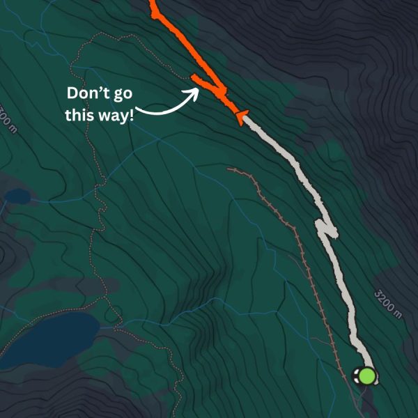
The main thing is – make sure you’re hiking UP.
You can also use the app AllTrails and have it running while you hike to Lake Dorothy. It’s really useful when it comes to trail-finding and you don’t have to get the paid version to use it offline.
AllTrails is what helped Lala and I realize we were going the wrong way!
3. What Makes this Trail the Best
When you turn right, that’s when the trail starts getting good.
You have to pass some waterfalls that actually go right over the path, but they aren’t deep at all. You can hop on rocks to get over the water. What’s amazing is that the creeks are pretty wide – it’s a lot of water and it’s so cool and refreshing!
As you hike, you’ll pass a lot of points to stop and gaze at the landscape, but one was my favorite. This is the picture we took there:
Try to see if you can find this spot while you hike!
Then, the hike goes through a really long talus field (which is just a bunch of fallen rocks), but the path through it is very clear.
Finally, a steep section welcomes you to get to the top of Arapaho Pass.
Behind you is everything you just hiked through and in front of you is an absolutely wild alpine ecosystem of lakes, snow and pure ruggedness.
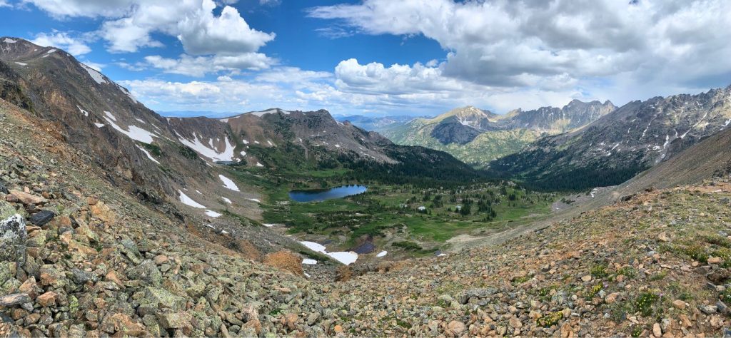
And still, you can’t see Lake Dorothy… where might it be?
4. Getting to Lake Dorothy (A Fork in the Road)
As you stand on the ridge of Arapaho Pass, continue on the trail, walking towards a sort of bowl in the mountains. This is what (I learned at RMNP), is called a “Cirque.”
Keep hiking and ignore the trail down and to the right. You definitely don’t want to go there because then you’ll have to hike back up some crazy switchbacks.
Finally, you’ll get to another fork in the road (and you still can’t see Lake Dorothy).
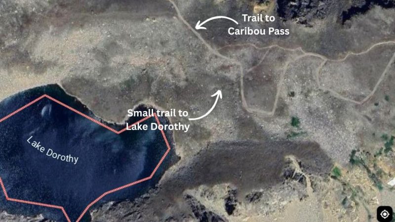
The path to the right looks like more people take it, while the one to the left isn’t as clear. That’s why I took the one to the right.
But, of course, Lake Dorothy was on the left path.
Then, you can enjoy the gorgeous lake. On July 9, there was still snow all the way down the mountains and over a third of the lake! It was quite a sight, and taking in the still, blue water was like a dopamine rush.
And, since my wife is way cooler than me, she wanted to get in the water. Since I get FOMO, we took a dip in the lake.
Oddly enough, it wasn’t the coldest water I got in during my Colorado road trip, but it was definitely the wildest setting!
The coldest water I got into in Colorado was in Great Sand Dunes National Park.
All that’s left after a dip and a picnic at Lake Dorothy, Colorado, is the hike down. The best part is that the view is even better all the way down because you get a line of sight straight down the valley.
Gear you Might Need
You honestly don’t need much gear to hike Lake Dorothy, but having the right gear will make a difference.
- For shoes, just take any footwear with good grip. If you worry about your ankles, the talus section can be a little sketchy and is the only part where you might need boots.
- In terms of clothing, I did it in shorts, but you could take some light pants. For your upper body, take a quick-drying shirt and a fleece jacket and you’re probably good to go. That being said, it gets real cold at the top, so you might want to take an extra layer for then.
- Take 1.5 liters of water and you’ll be fine.
- My go-to for summit meals is a heavy peanut butter and banana sandwich – just take something with lots of calories that you love!
- Though I don’t use hiking sticks for simple hikes like this one, my wife Lala did because she broke her hip a few years ago. They’re a game changer and take a lot of the load of your knees and muscles.
Free Camping near Lake Dorothy, Colorado
There are lots of spots where you can camp and car camp for free near Dorothy Lake, Colorado. Some, though, are way more convenient than others.
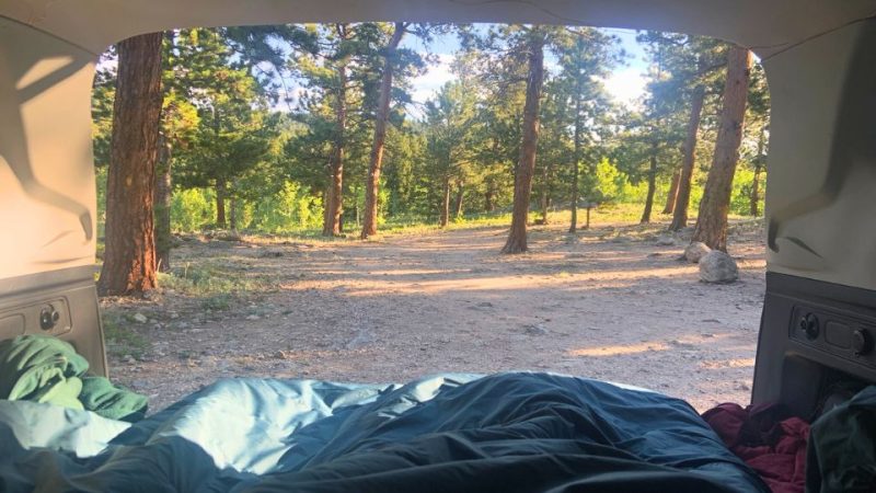
- At the Trailhead: According to my sources, you can camp for free at the Fourth of July Trailhead. They only have 10 tent sites and its first-come, first-served. I’m not sure about car camping, so be stealthy about it. You can also camp in the backcountry, which requires a permit.
- 34 minutes away: There are a ton of campsites right outside of Nederland, 34 minutes aways from the trailhead. They’re free and you can camp or car camp. When I went, they were are full!
- 40 minutes away: Not far from Nederland is the Gordon Gulch Dispersed Camping Area, which is also free. The only problem is that it’s a little sketchier – a good bit of trash and people living there. But it’s where we found a spot for 2 nights and it was great staying there!
These 3 aren’t the only free campsites, and don’t even get me started on paid campgrounds.
To look for more and do your own research before going, use the apps Campendium and iOverlander. You can also use freecampsites.net to find other sites near Lake Dorothy and Nederland.
On these apps and sites, you can look at other people’s reviews of the campsites before you do, which I’ve found super helpful.
I also made my own map of all the free car camping sites I found while researching for my Colorado road trip. You can access it here:
Other Lodging Options near Lake Dorothy, Colorado
Lodging in Colorado can be expensive, which is why I’m grateful there’s so much public land!
But if you’re planning on staying in a hotel, your best options are near Nederland, which is about 35 minutes from the Fourth of July Trailhead. There are some really cool hotels and rentals because this is a big ski area.
Check out your options in the map below:
Final Thoughts
Let me know how it goes if you do end up hiking to Lake Dorothy in Colorado!
And if you like Lake Dorothy, you’ll love two other incredible hikes on the Colorado road trip:
These two hikes, along with the one to Lake Dorothy, have been some of the best I’ve ever done. It helps that Colorado in the summer is utter perfection!