1, 2, or 3-day Death Valley Itinerary
Death Valley is the largest national park in the lower 48. That means there’s a LOT to do in this national park. So, how do you best take advantage of your time there?
Here’s a 1, 2, or 3-day Death Valley itinerary for you to see everything you need to see in Death Valley National Park.
I spent 1 day in Death Valley National Park, and it was a busy day. But there was SO much more I wanted to explore: gorgeous canyons, mountain peaks, incredible viewpoints and way more. All in all, you can get to know the park in a day, but the sweet spot for exploring Death Valley is 3 days.
This travel guide is the fruit of my research before traveling to Death Valley, from talking to park rangers and looking at the map! Let’s get into it!
1, 2, or 3-Day Death Valley Itinerary
Death Valley Itinerary – Day 1
The first day of this Death Valley itinerary is exactly what I did when I visited.
It’s a really busy day with lots of hiking and amazing views, but not as much driving. The day covers the most iconic landmarks in Death Valley for a perfect intro to the park. What’s nice is most of them are pretty close to each other.
If you’re going to be in Death Valley for just 1 day, do this itinerary.
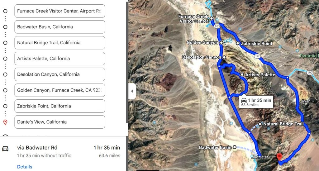
One Stretch of Road
Start out at the Visitor Center. You can get information for your travels there, but I also love Visitor Centers because of the learning experience. The park film in Death Valley is SO good.
After the Visitor Center, you’ll drive straight to Badwater Basin. Spend the rest of the day driving back on this stretch of road visiting the most famous places in Death Valley.
- Badwater Basin: the lowest point in North America, at 270 feet below sea level. It’s a place you just HAVE to see. It involves an easy walk deep into the salt flats to see the salt polygons, which is where the ground gets really textured.
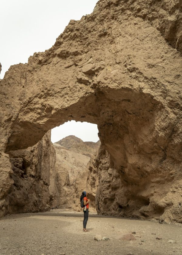
- Natural Bridge: this hike takes you to an arch that spans an entire canyon. It’s gorgeous. Most people turn back here, but hiking to the end of the wash is an even better experience.
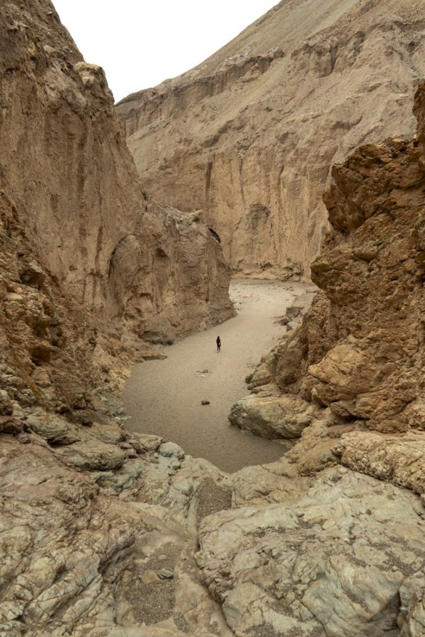
- Artists Drive: this scenic drive takes you up close and through the canyons of Death Valley National Park. The scenic drive has 2 stops to see the most colorful textured rocks.
- Desolation Canyon: This is a 3.6-mile hike through a canyon with a little bit of everything. I didn’t actually do this hike because I was too tired at this point, but it comes highly recommended.
- Golden Canyon: a 2-mile hike through a beautiful canyon with yellow walls. It ends at Red Cathedral, but you can also go on your own adventure through the gullies on the side of the canyon.
You can read about this exact 1-day Death Valley itinerary in more detail here!
A Mountainous Sunset
There are two amazing options to watch the sunset.
The most famous place is Zabriskie Point, which is 10 minutes from Golden Canyon. It gets crowded because it’s super close to everything. You have textured, colorful hills around you, the salt flats way out there, and Telescope Peak towering above it all in the distance.
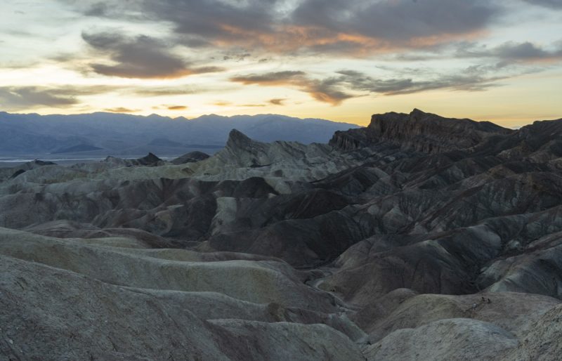
The place a park ranger recommended us to watch the sunset is Dante’s View. It’s a 40 minute drive from Golden Canyon, but that also means it’s less crowded. It’s also way higher in elevation, right above Badwater Basin, the lowest point in North America. That’s why it’s special – you get to see the lowest point in Death Valley and the highest point (Telescope Peak) as the sun sets.
The Most Convenient Lodging for Day 1
That’s that for Day 1 of this Death Valley itinerary!
After quite the day, you can stay at The Inn at Death Valley, which is close to the Visitor Center.
But if you’re feeling up for it, you can get a head start on tomorrow’s driving and stay at Panamint Springs Resort or camp for free on Lake Hill Road, like I did (I marked it on the map below).
If you’re planning any sort of trip in the Southwest, I actually made a free map with 70+ free car camping spots I found and vetted during my 2 years on the road. It’s my go-to resource whenever I’m planning where to sleep for the night.
👉 Grab the map for free below – I’ll email it to you right away!
Death Valley Itinerary – Day 2
Day 2 of this Death Valley itinerary includes 2 dune fields and a canyon.
Worry not, I made this itinerary so that you don’t need 4-wheel drive for any of it. Still, Death Valley is notorious for causing flat tires, especially where not many people go. So, make sure you’re prepared with extra tires and tools for that possibility.
Panamint Dunes
These star-shaped dunes are an adventure to get to, and worthy of an early start!
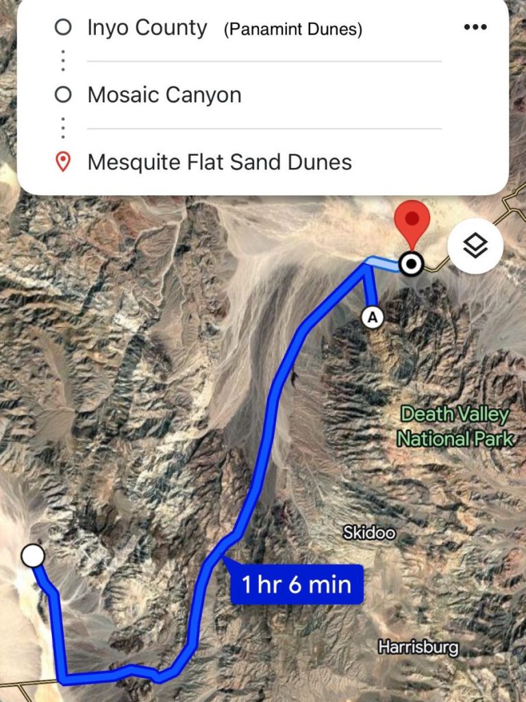
You drive to the end of an unmarked road called Lake Hill Road. From there, walk towards the sand dunes, which you can see to the north. The 3.5-mile hike to the dunes has no trail. Then it’s another 3.5 miles back. The Air Force commonly does low-elevation overflights here, so you might see that too!
A word of caution: Explore the Panamint Sand Dunes early in the morning. It might get way too hot later on in the day, even if it’s not the summer. And there’s no place to escape from the sun.
It’s not a difficult hike, but it is long and remote. So, take care and make sure you’re prepared!
That being said, the Panamint Sand Dunes are definitely “the path less traveled” in Death Valley National Park. You might not see a single soul.
Mosaic Canyon
After a gorgeous sunrise, drive back into the heart of Death Valley National Park. It’s a 45-minute drive from the Panamint Springs Resort to Mosaic Canyon.
To get there, look up Mosaic Canyon Trailhead. It’ll take you down a gravel road that pretty much all cars can get down. There’s a parking lot at the end and then the hike is on!
The season Mosaic Canyon is such an amazing hike is its diversity of views and experiences.
This 4-mile out-and-back hike has you walking through 3 different sets of narrows and has a gorgeous finish. You also get to scramble over a pile of rocks blocking the way (don’t turn back when you see it).
It’s a whole experience and a great adventure.
Sunset at the Mesquite Flat Sand Dunes
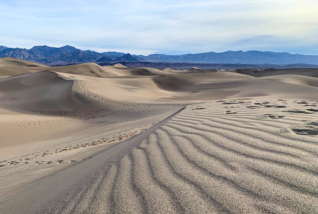
The day ends how it began… watching the sun do its thing atop a field of dunes.
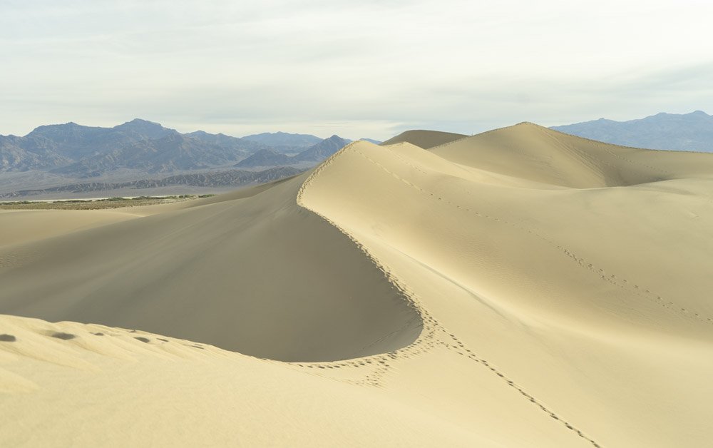
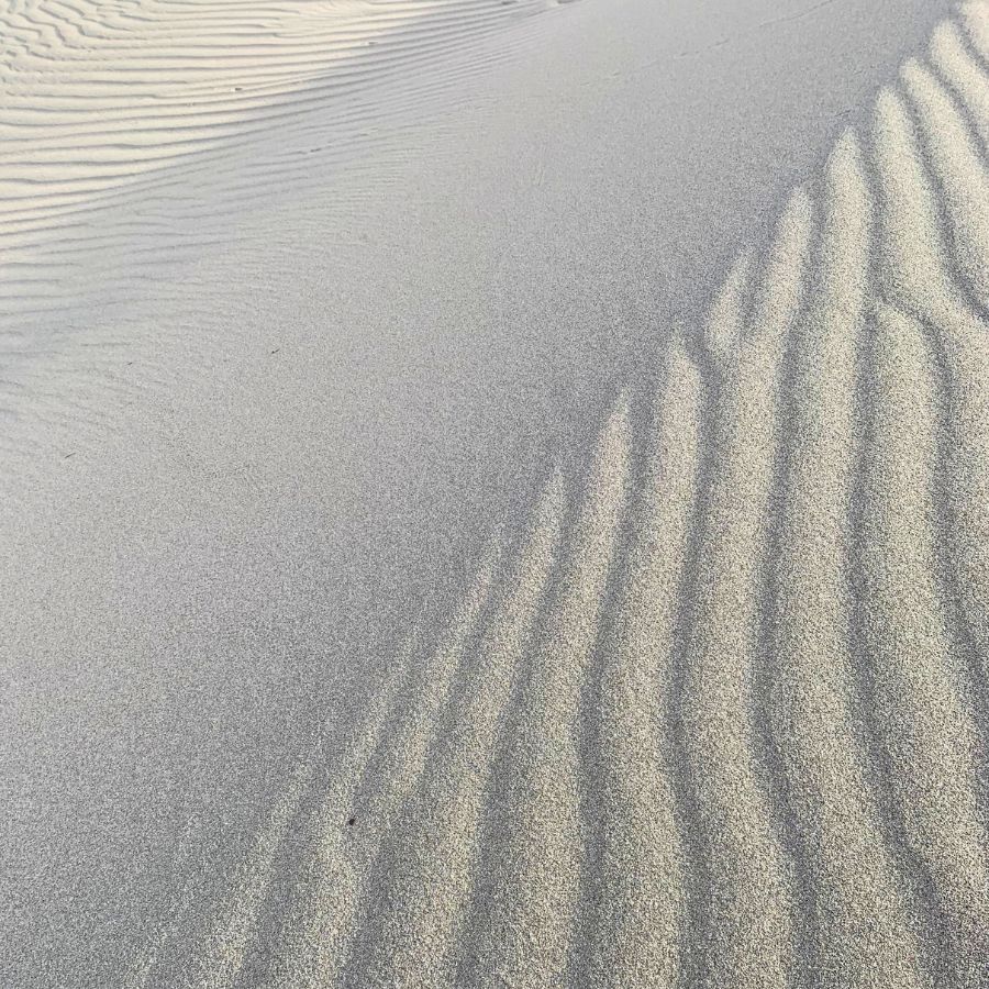
These sand dunes are just 12 minutes from Mosaic Canyon. Compared to the Panamint Sand Dunes, these are extremely accessible. The dune field starts right at the parking lot, and it only takes about 20 minutes to walk into the heart of the dune field (where the views are best).
Because of that, I recommend you get to Mesquite Flat Sand Dunes about 30 minutes before sunset. That way, you can walk into the dunes and get to see the dramatic light from deep in the dune field. It’s just so much better there.
I made the mistake of getting to the parking lot right as the sun was rising. It took me 20 minutes to get into the dune field, and the light just wasn’t the same. I wish I had been on top of the tallest dune!
Watching the sunset, you can stay a while longer and wait for the stars to come out. It’s a whole other experience, and SO worth waiting for.
The Most Convenient Lodging for Day 2
To finish off day 2 of this Death Valley itinerary, drive back to the Panamint Springs Resort, on the western edge of Death Valley. If you want to camp for free, do so on Lake Hill Road, which I marked on the map below.
This is where the best day in this Death Valley itinerary will begin.
Don’t get a head start driving to Lone Pine at night, because you’ll miss out on an INCREDIBLE scenic drive. If you do, however, most travelers recommend the Best Western Frontier Motel in Lone Pine. Otherwise, you can also camp for free in the Alabama Hills.
Death Valley Itinerary – Day 3
Day 3 of this Death Valley itinerary is special. It’s also a little more out of the way… but it’s SO worth it. It even takes you out of the park for a little while (to avoid REALLY rough dirt roads).
This day is a lesson in “America’s tallest.”
You’ll get to see the tallest mountain in the lower-48 states and see the second-tallest sand dunes in North America.
Scenic Drive
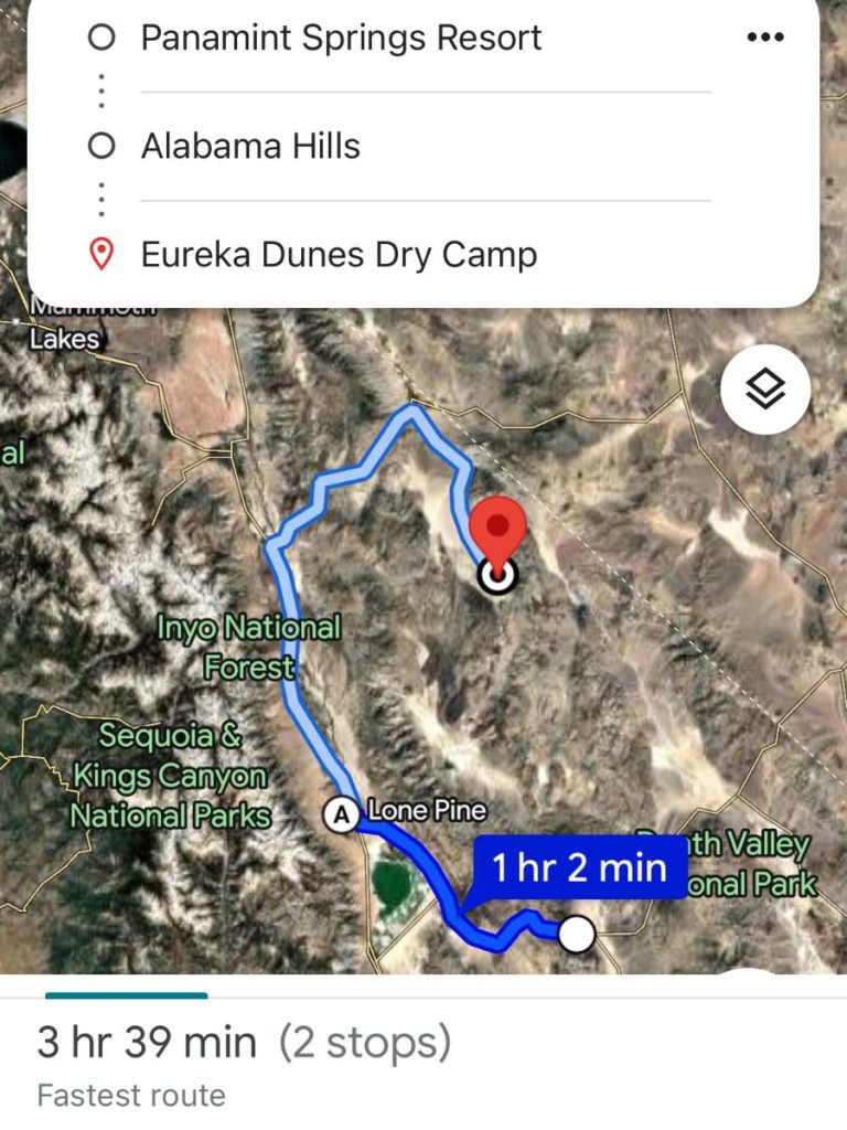
Drive west on CA-190 (the only road west from Panamint Springs Resort). This road will take you into the winding scenic drive through the mountains. You’ll see a lot of Death Valley from way above, including the Panamint Sand Dunes.
Why go this way? You get more bang for your buck in terms of what there is to see and do, and you drive over better roads.
As soon as you leave the mountains of Death Valley, the land gets flatter and less featured. But ahead of you, you’ll notice yet another mountain range. But it’s no small mountain range. As you get close, the mountains get bigger and bigger.
These are the Eastern Sierras, home to the tallest mountain in the USA outside of Alaska – Mount Whitney. There’s a special part of the road where we parked on the side and got out to take pictures.
When you get to a fork in the road, stay straight, following directions towards Lone Pine. This takes you to Highway 395, the eastern sierra scenic byway, one of America’s most incredible road trips.

Alabama Hills
The first stop is right under Mount Whitney – the Alabama Hills.
There’s so much you can do here!
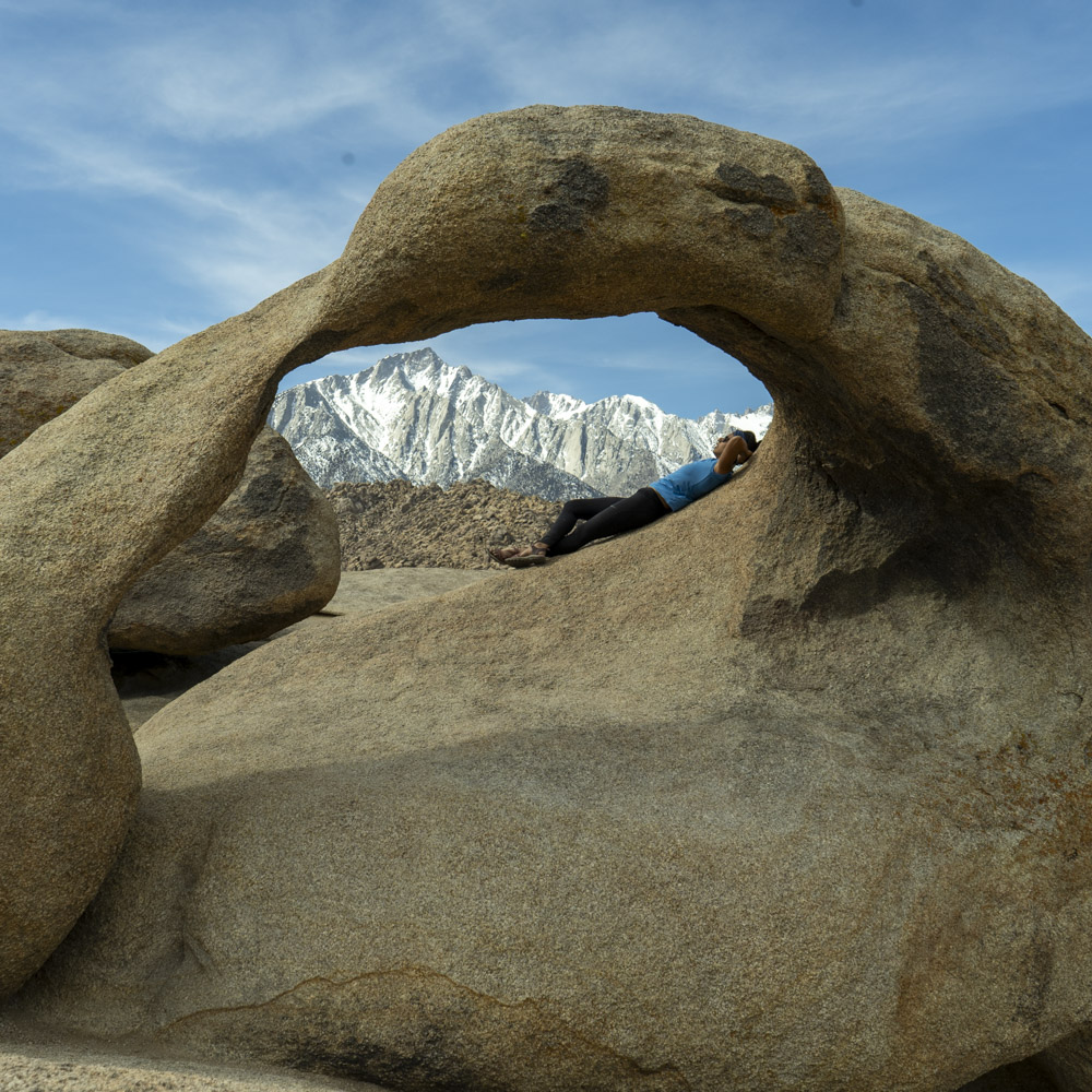
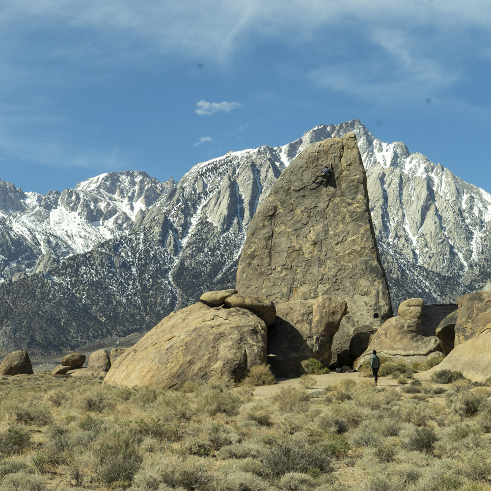
- Rock climbing: We visited the Alabama Hills to rock climb. There’s a lot of sport climbing and even more bouldering. The place looks a lot like Joshua Tree National Park in that there are piles of boulders of all shapes and sizes everywhere.
- Hiking: There are SO many trails it might be hard to choose one or two, but we enjoyed the Shark Fin Loop, which takes you to a rock that looks like a shark’s fin. Someone will most likely be climbing it! Then, we also enjoyed the Mobius Arch Loop, which was gorgeous and short.
- Movie sets: The Alabama Hills have featured in a lot of movies because it’s such a rugged, weird-looking place. My favorite spot was from Iron Man 1, when Tony Stark shows off his Jericho missiles. But you can also visit the spots where movies like Django, Star Trek and a bunch of old westerns were filmed!
Eureka Sand Dunes
These sand dunes are the second-tallest Sand Dunes in the US. Only the ones in Great Sand Dunes National Park are taller (and not by much).
The Eureka Sand Dunes are special, and that’s why they’re part of this Death Valley itinerary. They’re out of the way, in a secluded basin surrounded by mountains that make the sand dunes look tiny. Imagine yourself on top of a gigantic dune, surrounded by 7,000-foot mountains.
As you take a step on the edge of the dune, sand falls down the steep slope, causing a small avalanche of sand. And somehow, it makes the sound of an airplane far off in the distance. Nobody really knows why this happens.
Yeah, the Eureka Sand Dunes are SO worth visiting.
To get there, you can enter “Eureka Dunes Dry Camp” and any GPS will get you there. It does involve 10 miles of a rough graded road, and taking extra tires and safety equipment is highly recommended!
But going this way avoids 30+ miles of really rough terrain that most cars couldn’t get through. By driving through Big Pine instead of going through the park or around on the eastern side, all you need is high clearance and a real sense of adventure.
And just like that, you’ve learned how to spend 1, 2 or 3 days in Death Valley National Park. Day 1 covers the most famous landmarks, day 2 takes you to less well-known, most gorgeous spots, and day 3 is way out of the way to see the most epic views in this Death Valley itinerary.
Whether you’re driving from Las Vegas or LA, or visiting from anywhere in the country, Death Valley National Park will BLOW you away! It’s definitely one of the best American national parks.
I hope my planning, through this guide, has helped you plan your travels. As always, if you have any questions, comment below and I’ll be sure to answer!
Death Valley Attractions Map
I’ve put together a custom Google Map of this Death Valley itinerary with all the stops, viewpoints, and lodging options in this post.
This interactive map is perfect for visualizing your route through Death Valley National Park. Whether you’re walking on salt, driving next to the USA’s tallest mountain, or trekking to the Panamint Dunes, it’s all pinned and ready.
👉 Open the full map in Google Maps or see it embedded below. Tap the icon on the top left of the map to see the whole menu.
You can also get free access to all the free car camping spots I know around the USA:
Resources to Plan your Trip
- Camping in Death Valley (paid, free developed and free primitive)
- Lodging
- A BUNCH of Hikes
- The Official Park Map
- What roads are open and closed?
*This blog post contains affiliate links. This means if you click on a link and go on to buy the product I recommend, I will get a small commission, but you will not be charged any more – thanks in advance!