The Most COMPLETE Guide to Hiking in Valley of Fire State Park
Researching what hikes to do in Valley of Fire State Park was a little frustrating.
The information online is all over the place – even the official trail maps are different. And some of the maps don’t even include the most popular hike, Fire Wave.
So, I decided to write the most complete guide to hiking in Valley of Fire State Park. One ultimate guide in a single blog post.
My research went deep because I was only visiting for half a day.
I really needed to choose the best hikes. And I chose the right ones because I hike a lot all over the US, but hiking in Valley of Fire was the best hiking I’ve done in months.
This hiking guide is the result of my extensive research! First, I’ll talk about the two best hikes in Valley of Fire, which I did when I visited. Then, I’ll go into the rest of the hikes you can do, how to do them, and when to do them!
Let’s get into it!
Short on Time?
These are the best hikes in Valley of Fire:
1. Combine Fire Wave, Seven Wonders Loop & White Domes Loop (3.1 miles)
2. Rainbow Vista (1 mile)
4. Prospect Trail (5.5 miles one way)
What makes Valley of Fire Special?
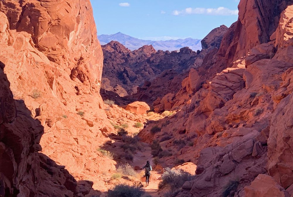
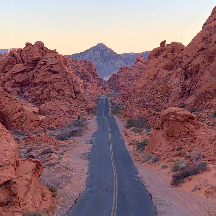
Valley of Fire is an other-worldly place. Nestled in between large dark limestone mountains, these towering red (and sometimes white) sandstone fins, domes and spikes rise from the ground like something from a fantasy world.
Valley of Fire State Park is more impressive and beautiful than a lot of national parks. The hikes I did were some of the most stimulating hikes ever. You turn a corner and there’s something new, something different. A single hike can have so much to see AND do (like scrambling on the rocks).
This was especially true about hike #1.
Hiking in Valley of Fire State Park
For reference, these are the two official trail maps I found for hiking in Valley of Fire: Map #1 and Map #2.
1. Seven Wonders Loop + White Domes Loop
The three most popular hikes in Valley of Fire State Park are Fire Wave Trail, Seven Wonders Loop and White Domes Loop. Fire Wave Trail is actually a part of the Seven Wonders Loop.
But there’s a way to do these 3 hikes as one. And if you’re hiking in Valley of Fire State Park, this is THE ONE hike you can’t miss.
The hike is 3.1 miles long and takes you through Rock of Gibraltar, Fire Wave, Pink Canyon and the Pastel Canyon slot, White Domes slot canyon, Thunderstorm Arch, the White Dome, Crazy Hill and Fire Cave, in that order.
I’m not sure what the “7 wonders” are, because I counted way more than 7!
Hike to Fire Wave
Start your hike at the Fire Wave Trailhead, or Parking Lot P3, and walk toward the giant rock formation. That’s the Rock of Gibraltar.
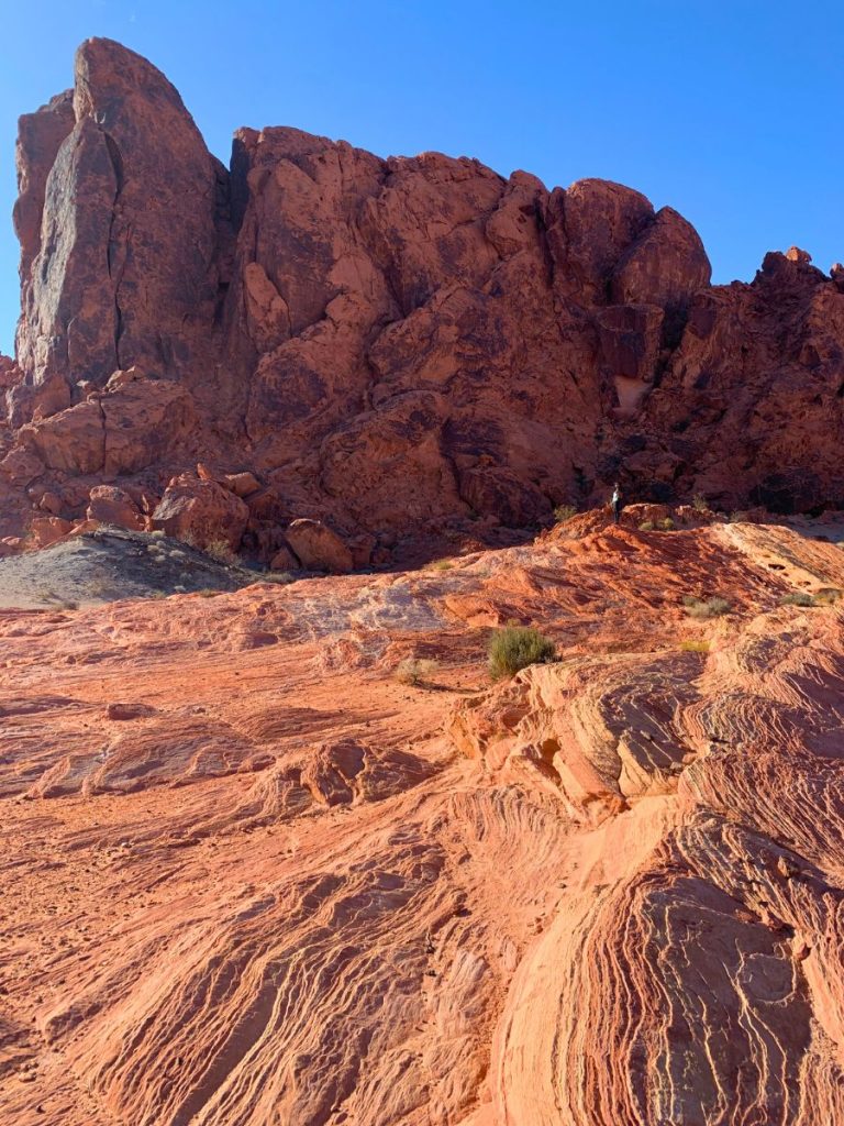
Following the trail, you’ll walk right of the Rock of Gibraltar and get to what I’ll call the Fire Wave area. Because Fire Wave isn’t just a single rock, it’s a long stretch of super textured, colorful rock formations.
Follow the obvious trail markers. The Fire Wave area ends at the most stunning part, where a couple of knobs with even crazier textures await. Red and beige streaks start right where you stand and go all the way to the knobs, swirling around them. It’s an abstract painting you can climb all over.
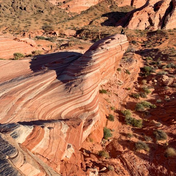

This part of the hike was the most crowded because it’s the most popular place for people hiking in Valley of Fire State Park. It’s also very accessible. Fire Wave is just over a half mile from the parking lot.
Hike through Pink Canyon
Right after the famous Fire Wave knobs, there’s a sign that says: “End of Fire Wave Trail.” This is where most people stop, but you’ll keep hiking. Enter a wash (a dry riverbed) and start hiking through Pink Canyon.
The rock here is gorgeous and… you guessed it, pink!
Soon after, the wash gets really narrow and you hike through the Pastel Canyon slot. The slot isn’t very tall and it has really round angles, as you can see in the picture below. While other slots are imposing and have rough angles like someone cut the rock, this one is almost cute.

After a bit, you get to a road. Cross it, and the hike gets even better.
The White Domes Slot Canyon
The trail after the road is THE definition of hiking in Valley of Fire State Park. You go through a couple other slots – but these are much more impressive. The first is really low to the ground but a super weird shape. The other one towers above you and you can touch both sides at the same time.
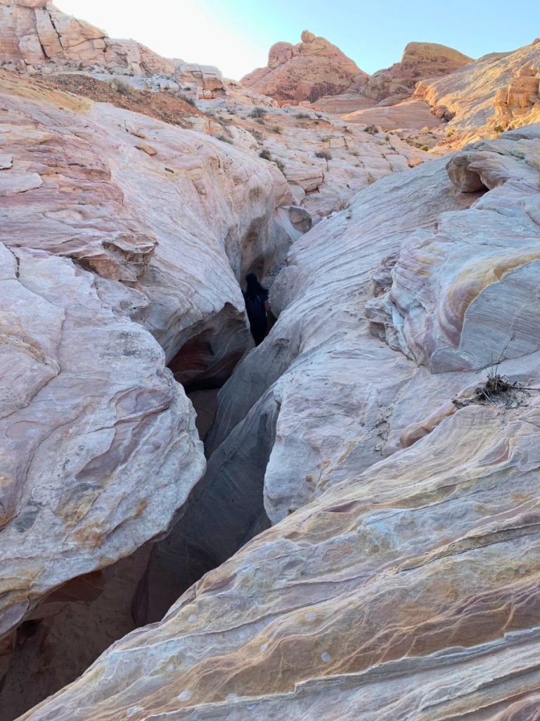
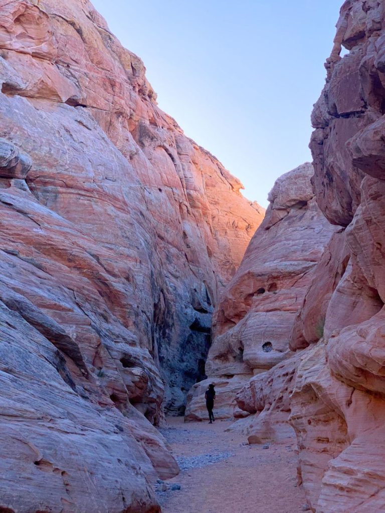
When you’re not in a slot canyon, you get views of gigantic fins of rock right above you and the occasional view of the stunning landscape far away.
Transfer to the White Domes Loop
Eventually, after the slot canyon, you’ll get to a sign with an arrow pointing to the right. If you go right, you’ll just finish the Seven Wonders Loop.
You want to keep going straight, staying in the slot canyon. Soon, it joins the White Domes Loop, where you can go right and up. But that part of the hike is best enjoyed hiking down later, so keep going straight, doing the White Domes Loop clockwise.
Hike to Thunderstorm Arch
After all that time hiking through slot canyons, it’ll eventually be time to hike up and right (the third time you get the option). It’s a beautiful part of the hike where you get more expansive views of everything around you and off in the distance.
Thunderstorm Arch is guarding the last part of the hike. You can walk through the beautiful arch, but it’s not that big.

After the Arch, you’ll loop over to the White Domes parking lot. That’s where we saw a herd of about 15 mountain goats running right next to us!
The White Domes
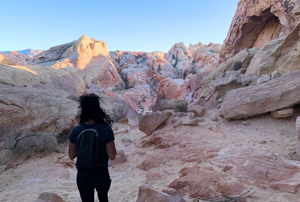
Walk to the other side of the parking lot. This is the White Domes trailhead. Get ready for the best views so far!
You start walking down, back towards the slot canyon you exited earlier. But you have an incredible view below and in front of you. Since the hike you just did on the other side is up all the way, now you’re walking back down.
The towering domes above you on both sides are perfect leading lines for the view ahead.
Transfer Back to Seven Wonders Loop
When the trail ends at the bottom of the path, you’ll notice you’ve been there before!
This is where you walked from the Seven Wonders Loop to the White Domes Loop. So, head into that short slot canyon again, turning left. Congratulations, you completed the White Domes Loop!
Once you get back to the sign on the Seven Wonders Loop, go left for the last stretch of the hike.
Crazy Hill and Fire Cave
The last stretch is all uphill – a tough way to end this hike. But the view makes it worth your while!
The hardest section is also the most beautiful: getting up Crazy Hill. It’s a hill with beautifully textured rock and the most random colorful streaks. It’s a great way to end the hike. And if you pause to breathe, don’t forget to look back because the view is spectacular.
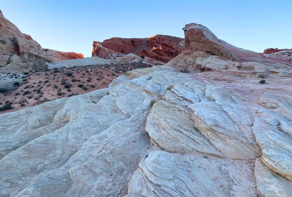
The last landmark on the Seven Wonders – White Domes Loop is Fire Cave. However, I never found it. The park closes at sunset and I was cutting it real close.
The hike ends right back where you started, at Parking Lot P3.
Like I said before, if you’re hiking in Valley of Fire State Park, this is THE hike you can’t miss.
Wow, that was a doozy of a hike description. I couldn’t find a good guide to combining Fire Wave, the Seven Wonders and White Domes Trails when I was researching… so I made it myself! I promise the rest of the hike descriptions won’t be nearly as long.
2. Rainbow Vista
This was the first hike I did in Valley of Fire State Park, and it was easy and gorgeous.
You start off at the Rainbow Vista Trailhead, about 5 minutes from the Visitor Center. The first short section of the hike is through a flat expanse of desert shrubs. It soon becomes a canyon, with a beautiful view of the canyon below you and clusters of red cliffs far off in the distance.
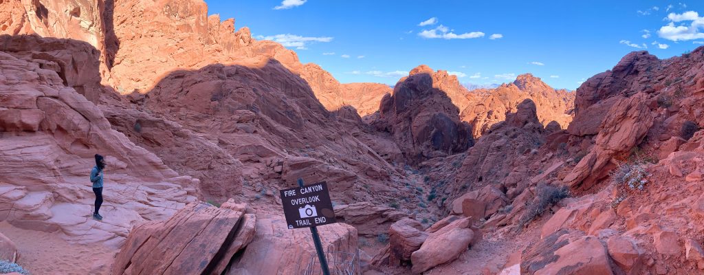
After the amazing view, you get to walk down all the way to where the trail suddenly ends. The canyon drops off and what’s in front of you is Fire Canyon in all its magnificence.
Since you’re slightly above it, you can see SO much. It’s seriously impressive. Like an intimidating forest of spiky red outcroppings.
Where the Rainbow Actually Is
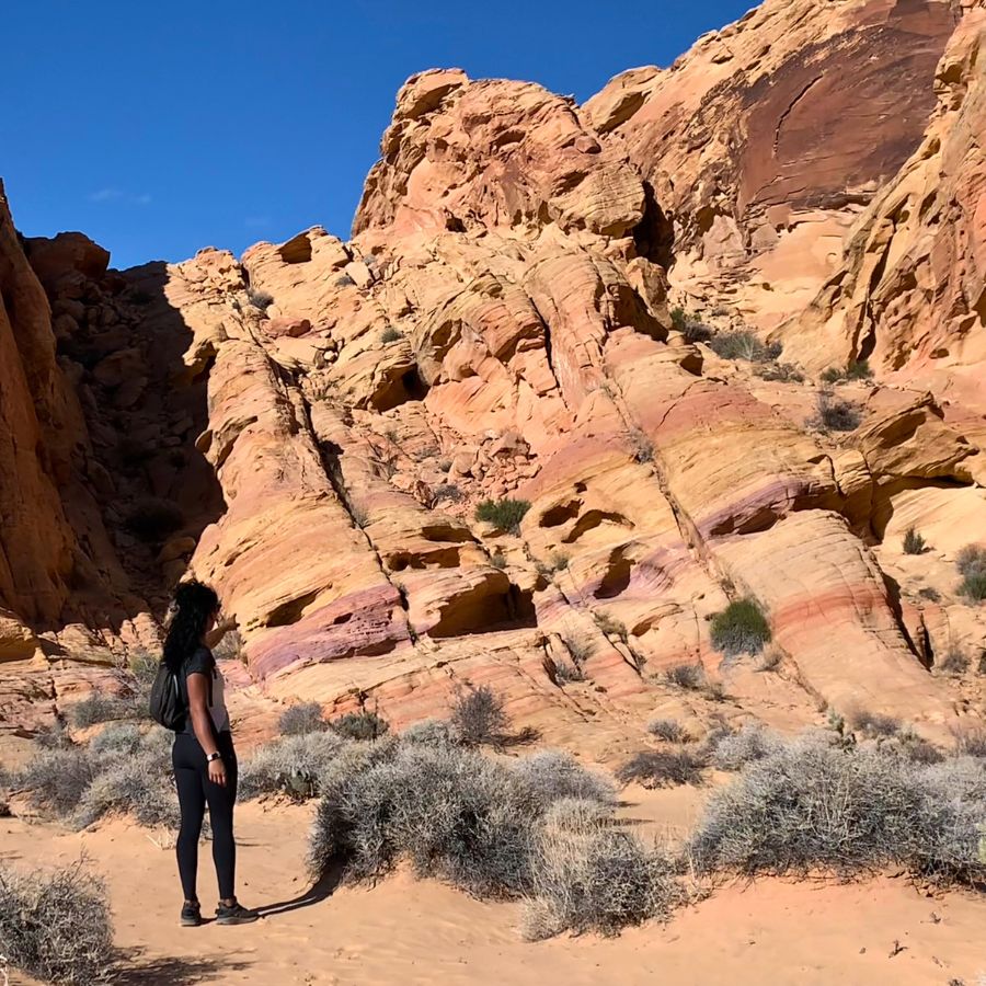
On the way back, after you pass the last big white rock on your right, you might see a vague trail going right. And if you look at the trail map at the Visitor Center, there’s a little loop at the beginning of the Rainbow Vista trail.
Go right (you can walk up that big white rock for bonus views) to see a rainbow that looks like it was painted onto the rock. I think most people don’t get to see the actual “rainbow vista” because this part of the trail is hard to see.
So remember that small loop!
3. Balancing Rock
This is an emblematic hike in Valley of Fire State Park because it’s short and easy.
The entire hike is 0.2 miles out and back, and you start right from the Visitor Center parking lot. If you’re looking at the Visitor Center, go left and you’ll find the trailhead. The hike to balancing rock is mostly flat!
It’s a beautiful hike, but not quite as amazing as the others deeper in the canyon. Still, balancing rock is a feat of nature – it defies gravity. I have trouble understanding how it came to be.
Do this hike if you prefer short hikes to see incredible formations. If you’re trying to tick off as many hikes as you can in Valley of Fire, this is a great one!
4. Petrified Logs Loop
As if Valley of Fire State Park didn’t already have a little bit of everything!
The Petrified Logs Loop is a short hike (0.3 miles, mostly flat) where you get to see petrified logs, or wood turned to stone. It’s a nice, easy hike with informative signs you can read to learn about the park and the petrified logs.
It’s a great, easy stroll to see something crazy. How does wood even turn to stone?
The only problem with this hike is that the petrified logs have metal fences around them. It makes sense, because people tend to be disrespectful of nature. But it’s off-putting to be on a walk and then find these random fences. That didn’t sound too attractive to me.
5. Charlie’s Spring
The Charlie’s Spring trail is one of the longer hikes in Valley of Fire.
It also has a bunch of trail descriptions online. Some say it’s 4.7 miles one way, others say it’s 2.5 miles one way, and others say it’s a 6.9-mile loop. The park map, at least, shows it as an out-and-back trail.
Two Things to Know
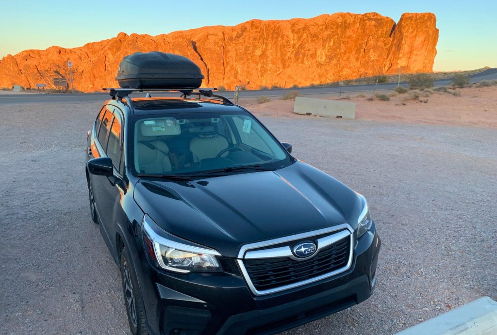
- The trailhead for Charlie’s Spring is the same as for Natural Arch. If you’re driving from the west entrance (from Las Vegas), the Natural Arch trailhead is to the left and the Charlie’s Spring trailhead is to the right. Best of all, you can put “Natural Arch Trailhead” into your GPS and it’ll take you straight there.
- One thing you’ll notice hiking in Valley of Fire State Park is that some hikes, especially the longer ones, aren’t well marked. There’s no big sign close to the road saying you’re there. So use your GPS or get really good directions at the Visitor Center. Or maybe you’re really good with maps!
How to Hike to Charlie’s Spring
There are two ways to hike to Charlie’s Spring:
- Start from the Natural Arch trailhead and follow the trail through the Valley of Fire Wash all the way to Charlie’s Spring. It’s pretty simple – stay in the canyon, hiking in between big formations and slots until you see water. Then turn back.
- To do the loop, do the same as above but keep walking through the main canyon until you see an old trail. Then follow a smaller wash and do some serious backcountry hiking. The toughest part of this loop is going the right way. If you want to do it, get advice from a park ranger at the Visitor Center!
6. Natural Arch
This trail is a wonderful option because it’s up to you how long to hike.
Start by heading in the opposite direction of Charlie’s Spring (so, left if you’re coming from Las Vegas). The first section is flat desert, but you’ll quickly get into a sandy wash. Once you’re there, that’s the Natural Arch trail and you can go as far as you’d like.
If you keep walking, you’d cross all of Fire Canyon and exit the park!
A good point to stop is once you can see Silica Dome. It’s a huge white dome you’ll definitely notice on your hike.
Alternatively, the park map says the hike is 2.5 miles long. So, you can just hike 1.25 miles, keeping track with an app like Strava or your watch, and then turn back.
You’ll see huge red rocks, walk through narrow slots and get to see rocks with some amazing textures and shapes. This hike is definitely for you if you like the freedom of having no destination and if you want to see a BUNCH of different things.
7. Silica Dome & Captain Kirk’s Grave
Valley of Fire State Park has a scenic drive within its scenic drive. Just after the Mouse’s Tank Trailhead, about 1.5 miles from the Visitor Center, turn right after a sign to Fire Canyon.
At the end of that road is the Star Trek Pilgrimage Site. Park there and then keep walking on the road to the left of the vault toilets. Shortly after, turn right on a trail towards Silica Dome, which is the obvious white dome that dominates the landscape.
You can hike up to the summit of Silica Dome, but be careful because there are some sheer drops.
Then, if you hike back down and keep following the path, you’ll find Captain Kirk’s grave. A Star Trek movie was filmed here, and a pile of rocks marks a special spot for Star Trek fans. After grieving for the fallen, hike back the way you came to your car.
8. Elephant Rock

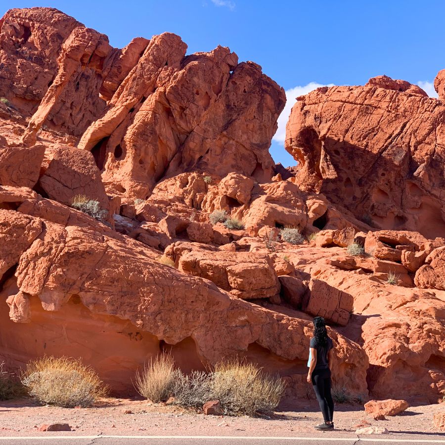
Elephant Rock is one of the most iconic landmarks in Valley of Fire.
The trail where you can see Elephant Rock is a 1.2-mile loop through a cluster of spiky red peaks. It’s amazing. The parking lot is at the east end of the park, right at the east entrance.
Hike along the highway back towards the west (away from the entrance). Keep hiking along the highway for quite a while. It will eventually loop back around the cluster of rocks where Elephant Rock is and you’ll arrive back in the parking lot.
Before starting the hike, I thought Elephant Rock would be somewhere in the middle of that cluster. However, Elephant Rock is just 0.2 miles from the parking lot. Since it was so close, we turned back after seeing Elephant Rock to go do other hikes.
Plus, Elephant Rock was a little disappointing. Seeing those huge red peaks in the distance, I thought Elephant Rock would be enormous. It wasn’t that big. As cool and weird as it is, my hopes were unfortunately a little too high.
9. Mouse’s Tank Trail
This hike is a short 0.75-mile hike out-and-back to two water tanks in the middle of Valley of Fire State Park.
To get to the trailhead, put “Petroglyph Canyon Trailhead” into your GPS. It’s 1.2 miles from the Valley of Fire Visitor Center and has a parking lot right next to it and picnic area across the street.
The hike is simple – you hike through Petroglyph Canyon, which has an impressive number of petroglyphs. At the end, you find the tanks and then turn back. As you’ll find a lot while hiking in Valley of Fire State Park, there are lots of chances to scramble over all the rocks off-trail. Just don’t scramble over any petroglyphs!
There are hidden arches for off-trail scramblers willing to look for them.
10. Pinnacles Loop
This is another of Valley of Fire’s longer hikes, but it might not be worth it.
It’s a 4.8-mile loop with about 450 feet of elevation gain. It’s an unofficial trail, so there will be way fewer crowds if you choose to do it.
To start, park at the Atlatl Rock Parking. Then, head back to the main road and cross the street. There’s a tiny sign that says “Pinnacles.” That’s where you start. From there, you’re going to hike around the ridge you can see to the left.
The hike is sort of boring until you get behind the ridge. Then, you get to THE pinnacles and it’s amazing. And then, it’s boring again to the end. It may not be worth it when there are such magnificent hikes in this park.
I found USA Adventurer’s blog post really helpful to get to know everything about the Pinnacles Loop.
11. Prospect Trail
This is the most popular long hike in Valley of Fire State Park.
It’s 5.5 miles, according to the trail map, one way. This presents a logistical challenge… if you don’t have 2 cars to leave one at the end, it makes this an 11-mile hike because you have to walk all the way back.
I wouldn’t do this one because I don’t love hikes where I have to see the same thing twice, especially when they’re long. But that’s just me.
The Prospect Trail begins at Prospect Trailhead, which I suggest you put into your GPS. Otherwise, the parking for this hike is just a pull-out on the road with a tiny sign for the trail.
After this, the trail is well marked with guide poles all the way. This hike is the best if you want to see… everything. It crosses almost the entire park, running parallel to White Domes Road.
The best part is that the Prospect Trail ends with the White Dome Loop. If you’re up for it, you could do the Prospect Trail, White Domes Loop and Seven Wonders Loop all in one go. With that, you could call it a day – you’re a Valley of Fire pro.
You can also hike the Prospect Trail backwards from White Domes. Just know the trail exiting the White Domes Loop is hard to see. The sign is tiny, right before going into a slot canyon. So be looking out for it!
12. Old Arrowhead Trail
This hike follows an old road. It’s part of a road that used to connect Los Angeles and Salt Lake City.
It’s not well maintained, but it does exist!
The hike starts about half a mile from the western entrance to Valley of Fire (closest to Las Vegas). It’s marked with a sign with an arrowhead on it. If you choose to do the hike, it takes you all the way to Elephant Rock.
The hike is south of the park’s main road, where there’s nothing else but the Old Arrowhead Trail. So if you don’t like crowds, you’ll LOVE this hike.
The problem is, Old Arrowhead Trail is almost 7 miles one way. So, unless you have 2 cars with you, it’s really a 14-mile hike through what isn’t the most amazing part of the park.
For the best description of Prospect Trail, I thought the guide on Hiking Project was the easiest to understand.
Free Camping in Valley of Fire
Though there’s camping in Valley of Fire State Park, Lala and I always prefer to find free camping.
Now, the free camping in Valley of Fire is actually really convenient. All of them are minutes from the park.
On the west, right on Valley of Fire Highway, there’s SeeYa Point Dispersed Camping and Valley of Fire West Dispersed Camping.
On the east, on Northshore Road, there’s Sand Mine Dispersed Camping and Poverty Flats Dispersed Camping.
If you’re planning any sort of trip in the Southwest, I actually made a free map with 70+ free car camping spots I found and vetted during my 2 years on the road. It’s my go-to resource whenever I’m planning where to sleep for the night.
👉 Grab the map for free below – I’ll email it to you right away!
Hotels near Valley of Fire State Park
Finally, is there a hotel near Valley of Fire State Park? Yes, but not THAT nearby. The closest hotel option is the North Shore Inn, about 30 minutes from the Visitor Center. However, there are some better, more luxurious hotel options further from the park, towards Mesquite and, obviously, Las Vegas.
Useful Things to Know for Hiking in Valley of Fire State Park
- These trails are closed due to the heat May 15 to September 30: White Domes Loop, Seven Wonders Loop and all it’s partial hikes, Pinnacles Loop, the Prospect Trail, Old Arrowhead Trail, Natural Arch Trail and Charlie’s Spring. Yea, it gets HOT here.
- Valley of Fire State Park is pet friendly! You can take your dogs anywhere except the Visitor Center, but they should be leashed.
- The park is open from sunrise to sunset. They actually state you’re trespassing if you’re there before or after. If you’re camping, you have to be in your campground from sunset to sunrise.
- These formations are not hikes: Arch Rock, Atlatl Rock, Petrified Logs East, Seven Sisters, Beehives, and Fire Canyon (it’s the scenic drive within the scenic drive).
- If you want to steer away from the crowds, do the longer hikes.
Road Trips with Valley of Fire State Park
- The Grand Circle road trip: This is best road trip in the American southwest and usually starts in Las Vegas. It takes you through some of the best American national parks and a bunch of other incredible landmarks, like Horseshoe Bend. Valley of Fire State Park would be an incredible addition to it. It’s cooler than some of the national parks on this road trip!
- Las Vegas area: Getting to know the area around Las Vegas is a great idea too, since there’s so much to do! The city is SO much fun, but you can venture out to Valley of Fire State Park, Red Rock Canyon, the Hoover Dam, Mojave National Preserve or go even further to Death Valley National Park, Joshua Tree National Park or the Grand Canyon.
- Utah Mighty 5: This road trip takes you through Utah’s 5 iconic national parks – Arches, Bryce Canyon, Canyonlands, Capitol Reef, and Zion. It starts or ends in Las Vegas, so you could consider a detour to Valley of Fire, just 2 hours and 15 minutes from Zion National Park and 1 hour from Las Vegas. Valley of Fire State Park is a perfect addition to the Utah Mighty 5.
And that, my friends, is the most complete guide to hiking in Valley of Fire State Park. If there’s anything I’m missing or you have any questions, comment below and I’ll be sure to answer!
*This blog post contains affiliate links. This means if you click on a link and go on to buy the product I recommend, I will get a small commission, but you will not be charged any more – thanks in advance!